Featuring a landscape lined with mighty peaks, barley, wheat, potatoes fields, orchards of juniper, poplar, and willow, Rupal is among the three most enthralling valleys in beautiful northern Pakistan. It is a large settlement in Gilgit-Baltistan, with a lower and upper village. The mountainside of Rupal valley is covered with forget-me-nots, lavender, and edelweiss.
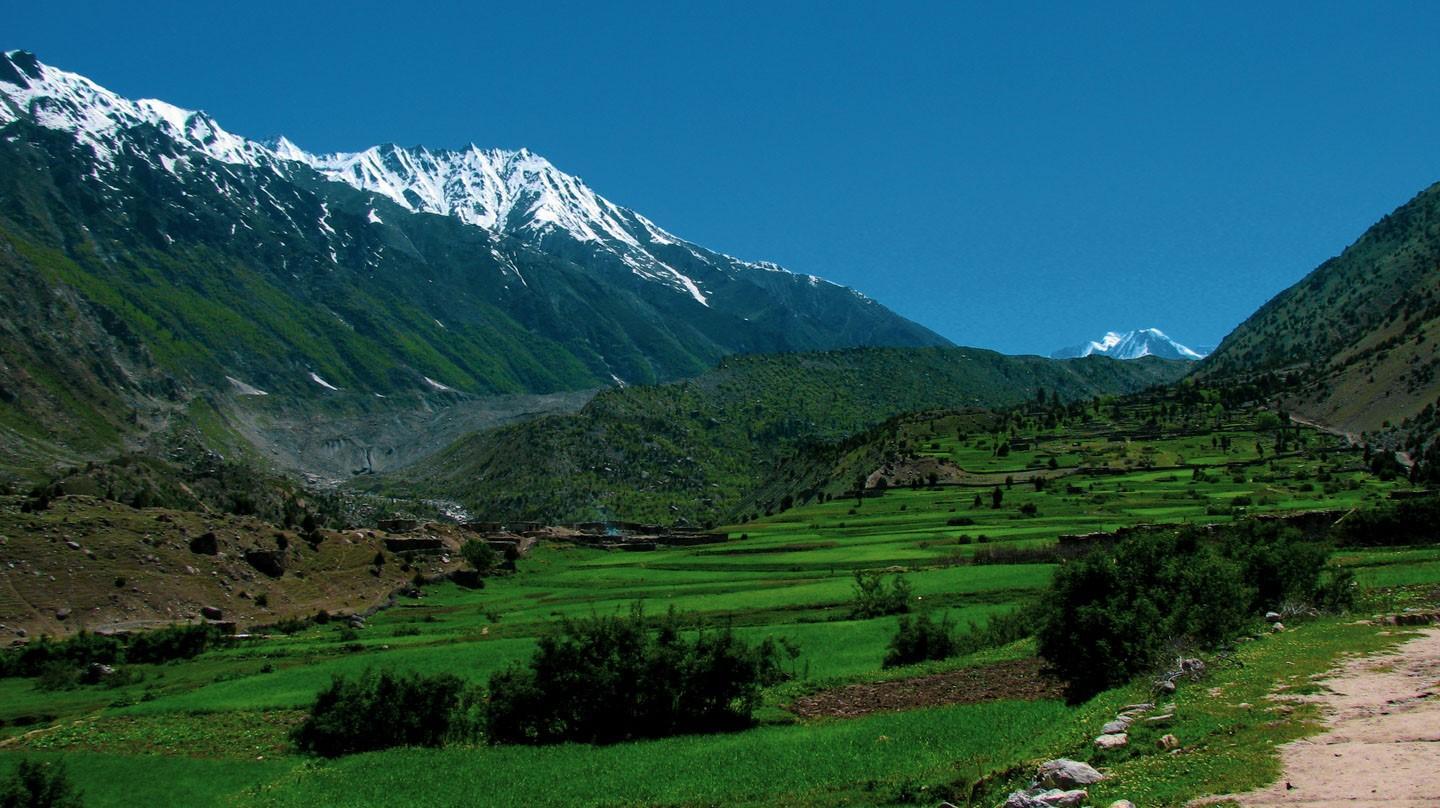
The magnificent valley, looking over the southern side of Nanga Parbat, is in the Astore District of Gilgit-Baltistan region. Across Rupal village, you can walk to the Rupal face of Nanga Parbat base camp, the best place to visit for capturing the majestic beauty of Rupal. The best time to visit the valley is in summer, from May to October.
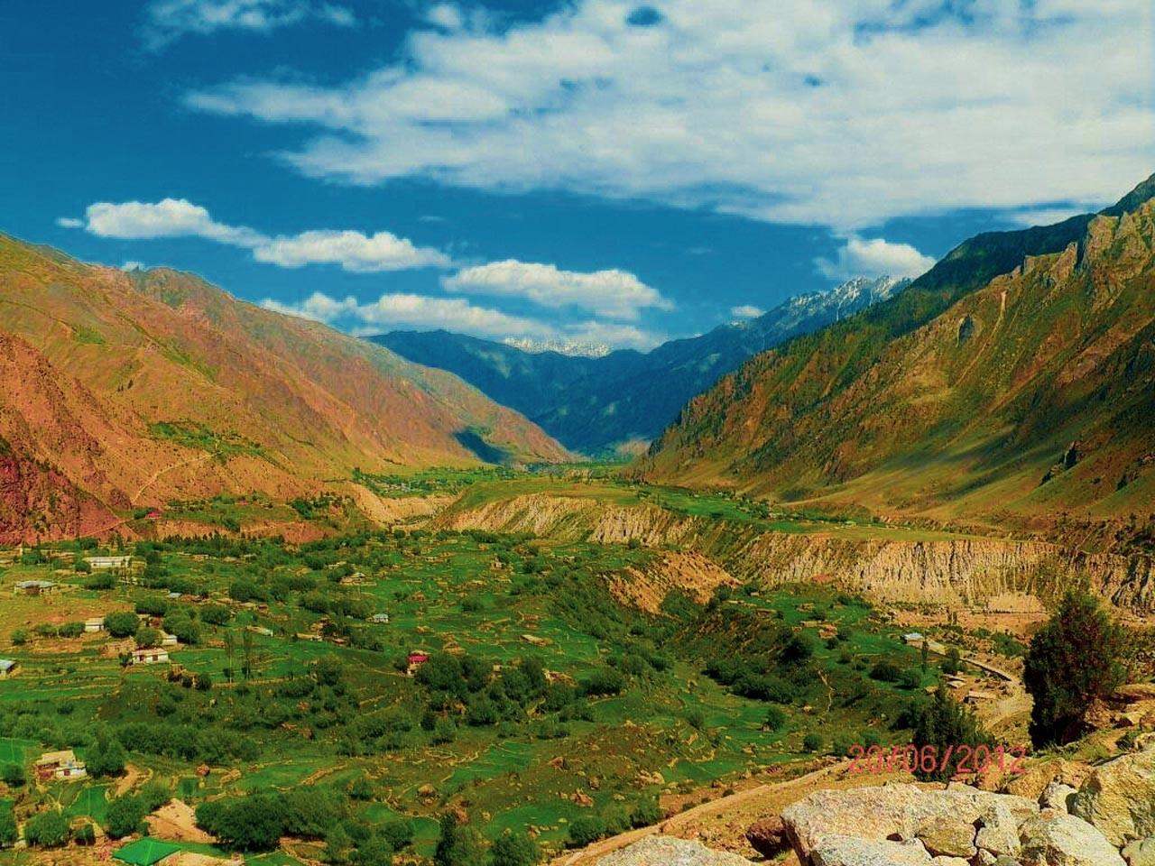
The Rupal Valley is accessible via Astore Valley, the route diverts from the Karakoram Highway at Jaglot, 60 km south of Gilgit. The valley is also accessible from Skardu, via Astore road, and the distance is 160 km making a drive of 6 hours. Tarashing village is the gateway to Rupal valley, and it takes about 2.5 hrs to reach Rupal village from Tarashing. You can also take on a side track to Rama valley and explore Rama meadows and Rama Lake.
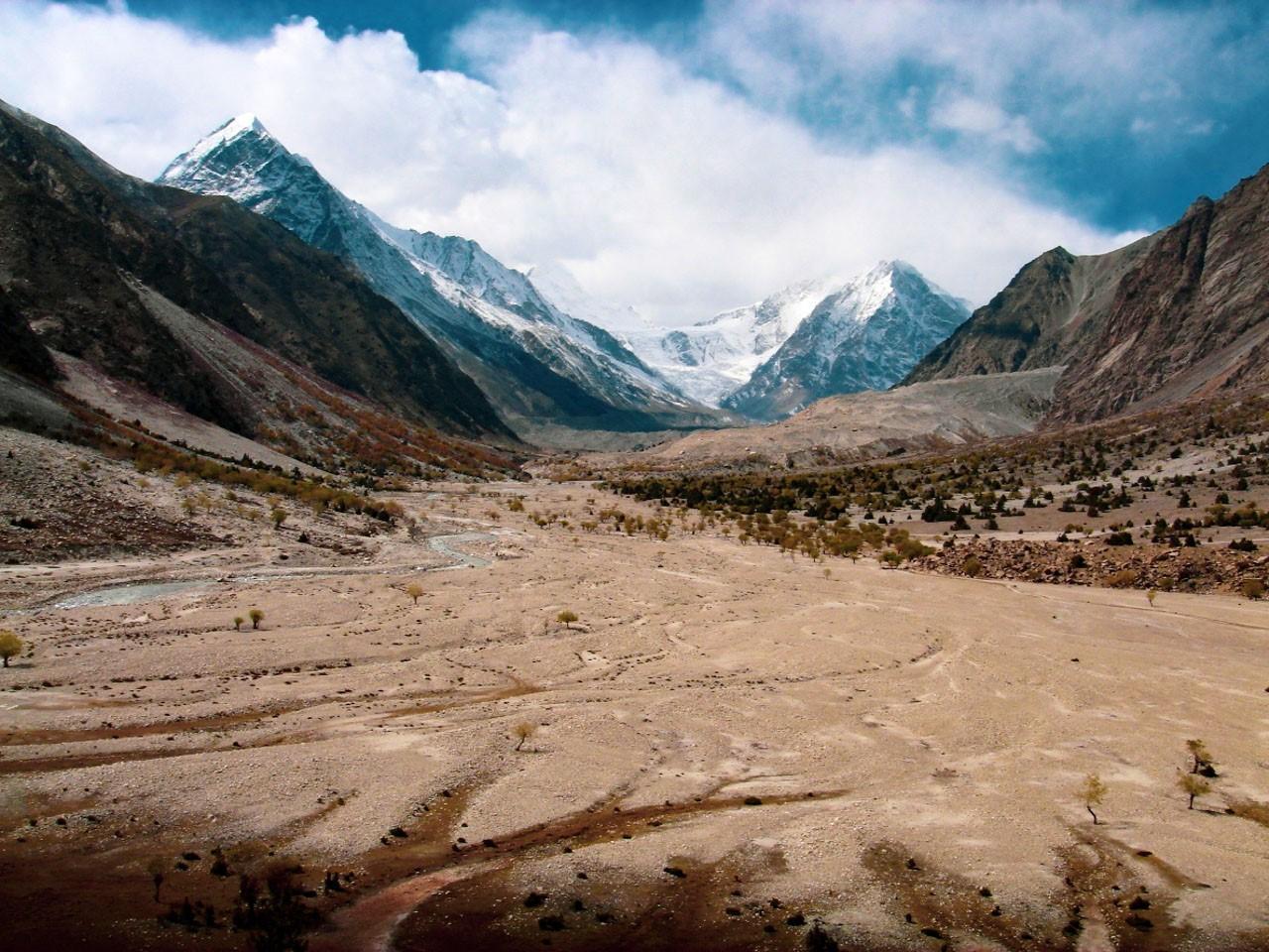
The trek starts from Tarashing village to Rupal valley and Rupal Glacier, also known as “Tarashing Glacier” and “Chhungphar” on some maps. Tarashing glacier lies in the sub range of Himalayas, the Great Himalayan. The glacier stretches from north of a 6,326-meter tall peak and flows northeastwards, south of the Laila Peak in Rupal valley. The melting snow from the glacier forms the Rupal River.
As you trek from Rupal village, after about two hours of a trek through narrow verdant alleys, poplar and willow woods, you pass a small lake to reach 3650 meters high Bazhin Camp. It is a flat, green meadow spread between the moraine of the Bazhin Glacier and the mountain with the towering ice wall of Nanga Parbat’s east face ahead.
The campsite is Herrligkoffer Base Camp, a beautiful meadow with a large spring bubbling crystal clear water and birds chirping in the woods. This campsite on the north side of the valley is named after Dr. Karl M Herrligkoffer, the leader of the first successful expedition to Nanga Parbat in 1953 and seven other expeditions.
Across the Bazhin Glacier over a trail, it takes 1½ hours to reach Latobah or Tupp meadows at an altitude of 3530 meters.
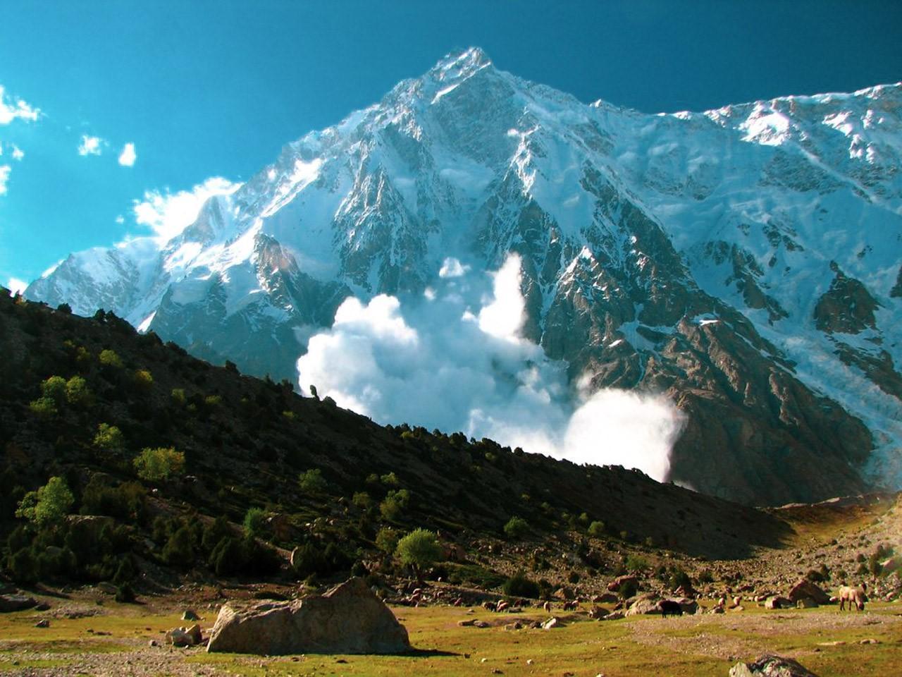
The trail stays to the north of the Rupal Gah, avoiding the terminal glacial till and a glacial lake in silty soil. Progressing on the trail through some silty glacial scape, you come across Shaigiri at 3655 meters. Shaigiri, meaning “white boulder” in Shina, is a summer suburb featuring an irregular boulder. The trek ends here expounding a more exceptional view of the Killer Mountain where it ascends vertically for about 4.6 km above Rupal as a straight wall of ice.
Tarashing village, a sub-division of Astore District, and gateway to Nanga Parbat is scantly populated with around 200 inhabitants. Most treks to Rupal valley start in Tarashing which is marked as the last village accessible by road in the area.
Tarashing village leads to Rupal Peak on the southern side of Rupal Valley, also known as the south face of Nanga Parbat. The Rupal peak is 9 km from Azad Jammu & Kashmir to its south-west. The easy trek trail to Rupal peak makes it perfect for climbers to get acquainted with climbing in Asian mountain ranges.
It is often compared with Group B trekking peaks in Nepal with minor difficulty. However, unlike Nepal, hiking to the Rupal peak doesn’t involve any license or permission requirements. Rupal peak was first climbed in 1964, by the most famous climber to have ascended Rupal Peak, Doug Scott, and renowned Pakistani mountaineer Nazir Sabir. More direct summits via the north face or northwest couloirs involve avalanche risk or rockfall.
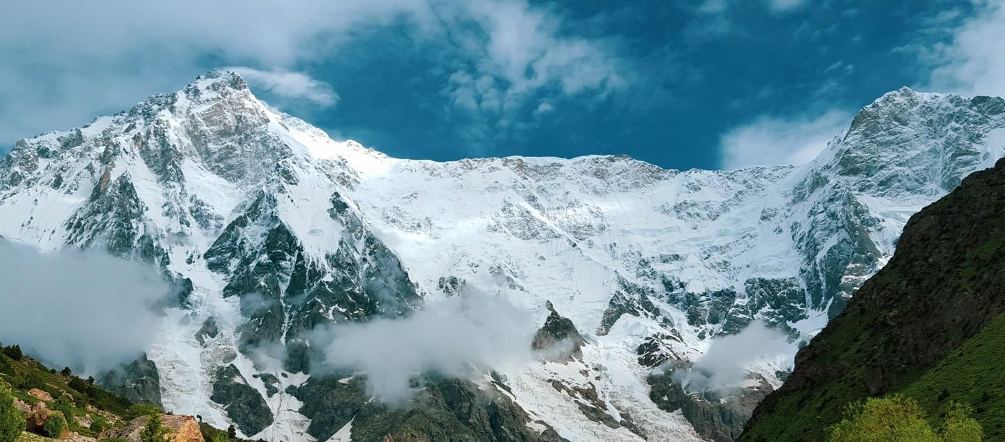
Another terrific peak at the southwestern boundary of Rupal valley is the Laila peak. A mountain with a spear-like shape in Hushe Valley near Gondogoro Glacier in Karakoram range soars about 5971 meters above sea level and 2290 meters above the Rupal valley floor. It lies south of the Rupal glacier and west of the Rupal peak. Laila peak offers a majestic view of its northwest face rising for 1500 meters vertically with a slope of 45 degrees.
The Rupal valley has two sections, the lower Rupal and upper Rupal. The people in the lower Rupal valley originated from Baltistan and their language is a fusion of Balti and Shina. Women here wear Balti headdress decorated with silver beads and buttons and a brown belt tail hanging down the back.
People in upper Rupal are called Gujars and the women here wear round hats covered with veils. The settlement has two villages where the houses are closely packed and half underground, with round hollow granaries nearby. In summers, people move further up the valley with their herds to feed on summer pastures, whereas in winter people stay in their houses and use the stored food.
Rupal valley is safe to travel by all kinds of tourists, just as in other areas of Gilgit-Baltistan.